New research shows high levels of shoreline modifications in communities on Vancouver Island’s east coast

Pacific Salmon Foundation (PSF) found that decades of coastal development have altered approximately 35 per cent of nearshore habitats critical for juvenile salmon and other coastal wildlife on a large portion of the east coast of Vancouver Island.
Between 2022 and 2025, PSF mapped the coastline from in a small 16-foot boat called Wilbur. The vessel recorded high-resolution imagery, before researchers digitized the structures they captured into the first publicly accessible interactive shoreline map of its kind.
“The east coast of Vancouver Island is a vital corridor for fish habitat and a nutrient powerhouse for other species in the Salish Sea, but much of its shoreline is now modified with unnatural structures,” says Kyla Sheehan, project manager of PSF’s Resilient Coasts for Salmon project.
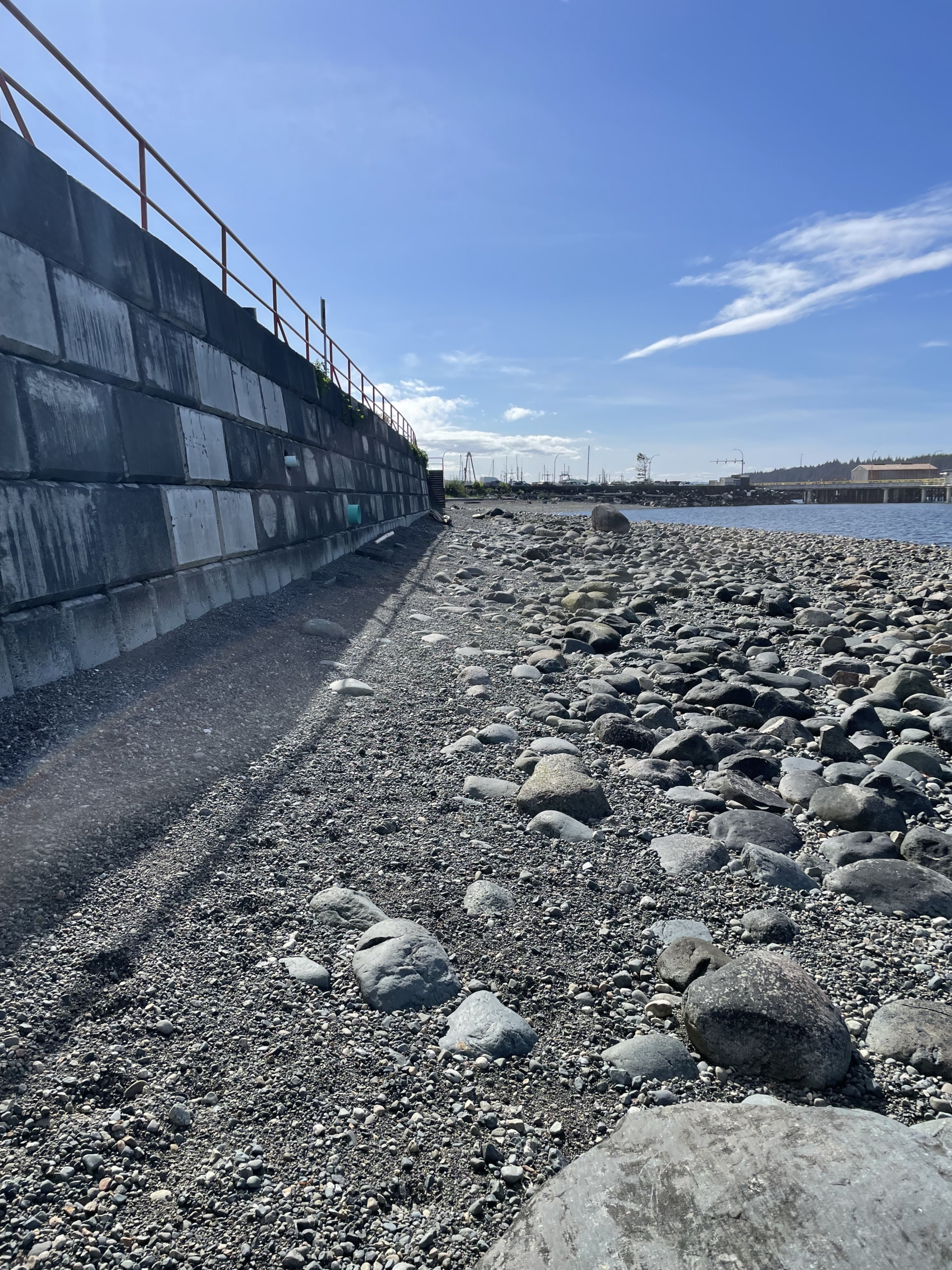
“Human-made structures like seawalls and excessive log buildup can disrupt natural coastal processes, degrade habitat quality, and impact species that rely on nearshore environments, including Pacific salmon.
In the spring, juvenile Pacific salmon rely on nearshore areas for shelter and food as they adjust to the ocean after exiting river systems up and down Vancouver Island. Healthy shorelines are also essential for the survival of other species, such as Pacific herring, Pacific sand lance, and surf smelt.

Up to 69 per cent of shoreline modified in Island communities
Researchers found that shoreline modification in Vancouver Island’s biggest coastal cities was significant, through structures like marinas, vehicle bridges, breakwaters, boardwalks, and seawalls.
These structures – often built to protect shoreline infrastructure – can make erosion worse by redirecting wave energy to nearby areas and contribute to ‘coastal squeeze’, a phenomenon where habitat can be lost over time when the shoreline is not able to adapt to changing sea level. They also threaten key spawning and rearing habitat for forage fish.
Shoreline modification varies significantly by community. Percentage of shoreline modification in Vancouver Island cities:
- City of Campbell River – 69 per cent
- Town of Port McNeill – 60 per cent
- Comox Valley Regional District – 47 per cent
- Victoria & Esquimalt urban waterfront area – 46 per cent
- Regional District of Nanaimo – 30 per cent
PSF’s map also measures log accumulation along the coast. Logs that escape from log booms can scour beaches and smother vegetation, damaging coastal ecosystems and salmon habitat. For example, in Nanaimo, 30 per cent of the shoreline was found to have moderate to extreme log accumulation.
Solutions in Esquimalt and Comox
Restoration work is underway to mitigate the impacts of coastal development. PSF has worked with partners on two recent projects that re-naturalized the shoreline and removed human-made structures on Vancouver Island.
In the Comox Valley, PSF and partners will unveil Dyke Road Park this summer, which has removed hard armouring and concrete structures to reduce erosion and flood risk along the coastline. A new tidal channel promises to provide refuge for juvenile salmon.
In March, Esquimalt Gorge Park was re-opened to the public after a five-year re-naturalization project, in conjunction with the Township of Esquimalt, Stewardship Centre for BC, and Capital Regional District. Restoration work removed concrete rubble, regraded the shoreline and, planted native species.

Visit PSF’s Resilient Coasts for Salmon Atlas to explore coastal modification on Vancouver Island. View information on specific Island communities via these links: Victoria, Nanaimo, Comox, Campbell River, and Port McNeill.
Click here for maps, photos and video clips from the project.
The Resilient Coasts for Salmon project was funded in part by the Government of Canada and is a collaborative initiative led by the Pacific Salmon Foundation with partners such as the Stewardship Centre for BC, World Wildlife Fund — Canada, Peninsula Streams and Shorelines, and others.
The project acknowledges the ongoing stewardship of shorelines by First Nations on Vancouver Island for time immemorial. The shorelines within First Nation reserve lands were not digitized for this project out of respect for privacy.
Media inquiries: Contact Oscar Beardmore-Gray at obeardmore-gray@psf.ca or 604-664-7664 ext. 1010
