Earth Day: Know Your Shores
Celebrate B.C.’s coastal ecosystems on Earth Day with PSF.
Did you know that the Strait of Georgia— a marine corridor between Vancouver Island and the southwestern mainland coast of British Columbia — supports more than 3,000 species, including Pacific salmon?
And three-quarters of B.C.’s human population lives near the Strait.
On Earth Day, April 22, you can support the Strait of Georgia by respectfully observing wildlife, making sustainable decisions, and learning about climate impacts on coastal ecosystems.
The Pacific Salmon Foundation (PSF) presents 10 tips to get to know your local coastal ecosystems to celebrate Earth Day. Find out how you can take action in your community or plan an eco-friendly marine adventure.
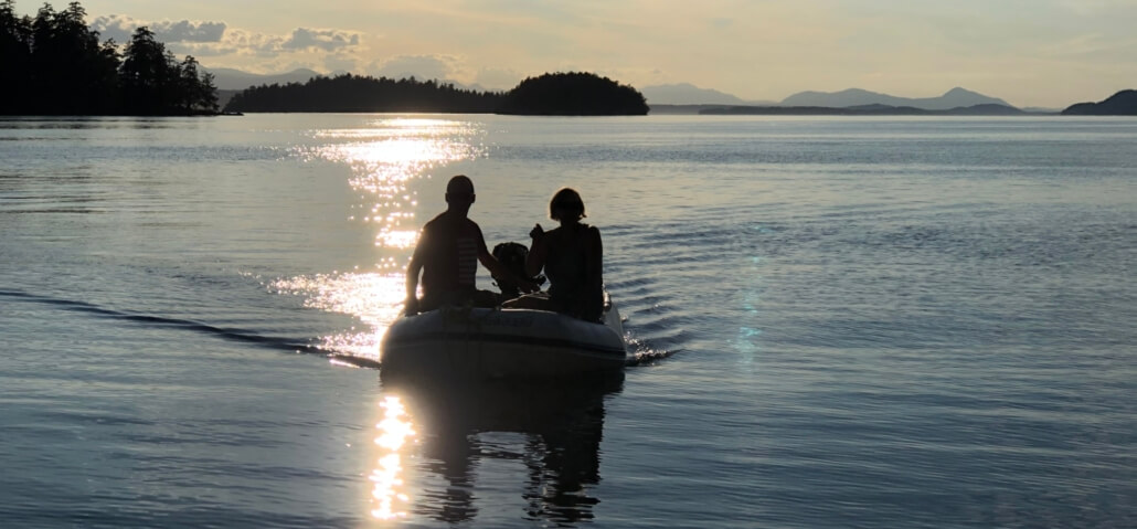
- Planning a kayak rendezvous on Earth Day? Look out for some incredible wildlife while you’re out on the water. Use PSF’s mapping tools to ensure your route overlaps with seal and porpoise habitat. Keep your distance from marine creatures to minimize creating unnecessary stress on the animals.
- Go birdwatching in the Strait of Georgia! Plan an excursion near bird species such as eagles, oystercatchers, ducks, herons, loons, grebes, and more. Don’t startle the birds – keep quiet and avoid sudden movements.
- Visit one of your local estuaries, strolling on an established path, while you admire this ecosystem that is vital to many species, including salmon. Take a moment to recognize the role this habitat plays in safeguarding from threats, such as filtering pollutants en route to the sea.
- Plan a sustainable boat trip and protect sensitive eelgrass habitat. Eelgrass meadows provide critical habitat for juvenile salmon, yet boat moorings can fragment the key habitat. Compare locations of established mooring sites and eelgrass meadows to avoid any incidental damage.
- Ready to explore the shore? Take this treasure hunt activity sheet down to your local shoreline and see what organisms you can spot! Be sure not to disturb these organisms, and remember to leave everything as you found it. Download the worksheet here.
- Plan a shoreline cleanup in your community. Determine the zoning of a coastal area so your group can best plan beachside restoration efforts in public areas.
- Easy tips to prevent marine microplastic pollution at home such as washing in cold water or opting to hang-dry your laundry rather than using the drying machine. Make conscious decisions when doing your laundry to prevent microplastics from entering the marine environment, because once they do, they are impossible to clean up.
- What will sea-level rise look like across B.C.? Learn about climate change impacts in your region by comparing shoreline sensitivity to future sea-level rise projections in different communities in and around the Strait of Georgia.
- How can nature-based solutions improve our responses to climate change? While traditional structures, such as seawalls, docks, and piers degrade over time and are vulnerable to sea-level rise, nature-based solutions can be used to protect our shorelines. Learn more about using nature-based solutions to protect waterfront properties while simultaneously conserving and restoring habitats for key species, including Pacific salmon.
- Join a local stewardship group in your community. Volunteer your time to participate in beach clean-ups, habitat restoration, invasive weed removal, or another activity helping our environment that is close to your heart. Find a group near you.
The Strait of Georgia Marine Reference Guide
The Strait of Georgia Marine Reference Guide (SOG MRG) is a product of PSF’s Strait of Georgia Data Centre. The tool centralizes and visualizes more than 400 data layers relevant to the Strait’s marine ecosystem into one digital library. Visit the tool here and leave feedback here to help shape the evolving interactive map.
How to use the Marine Reference Guide
When the map is fully loaded & you’re ready to begin exploring, we recommend you orient yourself using the following first steps:
 widget.
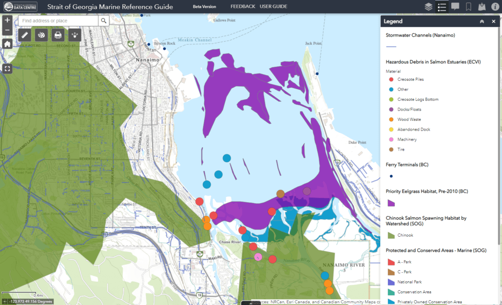
Threats to salmon habitat (i.e. stormwater, hazardous debris, ferry terminals) displayed alongside key habitat areas (Chinook spawning watersheds, eelgrass, protected and conserved areas) in the Nanaimo River Estuary.
PSF’s Resilient Coasts for Salmon Program
Resilient Coasts for Salmon is a partnership between the Pacific Salmon Foundation, the Stewardship Centre for BC, the World Wildlife Fund – Canada, Peninsula Streams Society, and others. This project was funded in part by the Government of Canada. Check out the Climate Change Primer and the Online Tool Kit to learn more about nature-based solutions.
Support PSF’s free, public-access tools! Make a donation.

